Quote of the Month:
“Nature gives to every time and season some beauties of its own." - Charles Dickens
“Nature gives to every time and season some beauties of its own." - Charles Dickens
| Location: | Snoqualmie Region, Snoqualmie Pass Area |
| Roundtrip: | 3 miles |
| Difficulty: | Moderate |
| Elevation Gain: | 1330 feet |
| Highest Point: | 5052 feet |
| Season: | The Forest Road, leading to the trailhead, is usually snow-free from July till November |
| GPS Coordinates: | N 47 22.208 W 121 26.658 |
| Visitor’s Information: |
Northwest Forest Pass Required |
If you are looking for some great vantage points opening spectacular panoramas in front of you… If you are yearning for the breathtaking views of gorgeous mountains, but are limited in time, then the Mount Catherine Trail will perfectly suit you. Being only 3 miles long (roundtrip) the Mount Catherine Trail will take you to the very top of the Mount Catherine’s summit in less than an hour. But mind, that your payment for the trail shortness will be the grade of the ascent, which will make the hike quite strenuous for casual hikers.
You can reach the Mount Catherine Trailhead by driving the Forest Road 9070, which leads to several trailheads in this area. Be prepared for quite a tough drive as the road has a lot of potholes and some big sharp rocks.
You won’t actually find a usual trailhead; there is only a widening of the road with the parking space for 3-4 cars. Thus be careful not to miss the trail sign. There is also no restrooms or water sources at the trailhead.
At the beginning the Mount Catherine Trail follows an old logging road, branching from the FR-9070 on its north side. But already after approximately 300 yards it turns into a rocky path and starts ascending a steep hill in a series of switchbacks.
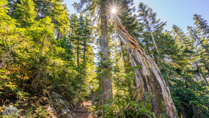
Striving the steep hike do not forget to look up from time to time to enjoy the old-growth forest you are walking through, the conifers of which include some subalpine fir trees as well as western and mountain hemlocks. From time to time you will also meet the patches of huckleberry bushes, providing the hikers with a tasty treat in August-September and with magnificent colors in October.
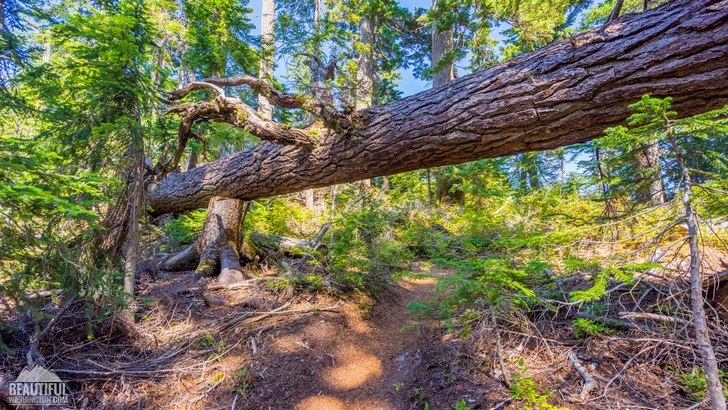
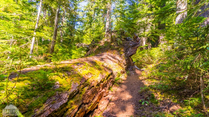
There are quite many huge trunks of the fallen trees along the trail, a couple of them blocking the way, but it’s easy to pass them either hopping over them or going under it.
After 0,7 miles (which is almost the half of the trail distance), you will reach the ridgeline. The grade of the ascent is getting milder here, which will give you about 0,6 mile’s rest before the final scramble.
Here you can get the first glimpse of the fantastic views preparing you for what is waiting for you ahead.
The last 20-foot climb to the top of the summit is really steep and hard, but to help the hikers there is a bolted cable there, which you can grab helping yourself to scramble up the hill. And here at the top of the summit you will get your payoff for all the efforts during the climb!
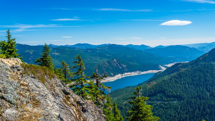
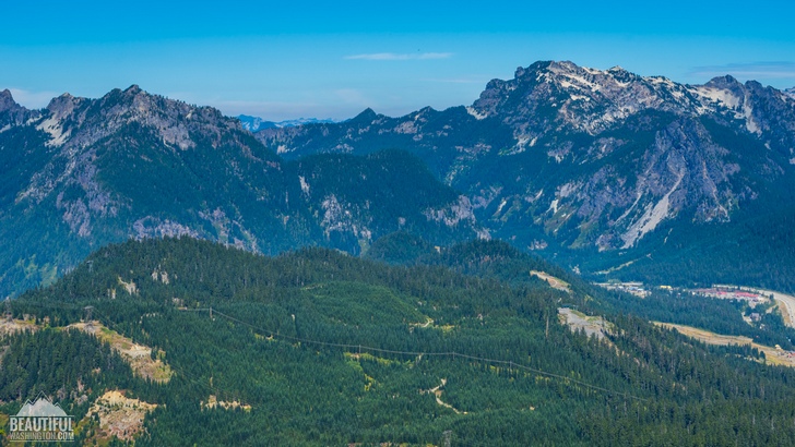
Check the weather forecast before planning your hike to choose a sunny day for the trip, as fog and clouds may cut down the view, preventing you from enjoying the incredible mountainous scenery around you. Mount Rainier, Tinkham and Silver Peaks, Humpback and Red Mountains – these are just some of the impressive features waiting for you to take your breath away. Look down and you will see the deep blue waters of Keechelus Lake with I-90 running along its shore. Priceless serene views, which create precious unforgettable memories!
On the top of the summit of Mount Catherine you may find some old and rusted cables and bolts. These are the remnants of the navigation beacon, built in 1930s and intended to guide the planes through this low area of the Cascades.
 Mount Catherine Trail 01
Mount Catherine Trail 01
Mount Catherine Trail 01
 Mount Catherine Trail 02
Mount Catherine Trail 02
Mount Catherine Trail 02
 Mount Catherine Trail 03
Mount Catherine Trail 03
Mount Catherine Trail 03
 Mount Catherine Trail 04
Mount Catherine Trail 04
Mount Catherine Trail 04
 Mount Catherine Trail 05
Mount Catherine Trail 05
Mount Catherine Trail 05
 Mount Catherine Trail 06
Mount Catherine Trail 06
Mount Catherine Trail 06
 Mount Catherine Trail 07
Mount Catherine Trail 07
Mount Catherine Trail 07
 Mount Catherine Trail 08
Mount Catherine Trail 08
Mount Catherine Trail 08
 Mount Catherine Trail 09
Mount Catherine Trail 09
Mount Catherine Trail 09
 Mount Catherine Trail 10
Mount Catherine Trail 10
Mount Catherine Trail 10
 Mount Catherine Trail 11
Mount Catherine Trail 11
Mount Catherine Trail 11
 Mount Catherine Trail 12
Mount Catherine Trail 12
Mount Catherine Trail 12
 Mount Catherine Trail 13
Mount Catherine Trail 13
Mount Catherine Trail 13
 Mount Catherine Trail 14
Mount Catherine Trail 14
Mount Catherine Trail 14
 Mount Catherine Trail 15
Mount Catherine Trail 15
Mount Catherine Trail 15
 Mount Catherine Trail 16
Mount Catherine Trail 16
Mount Catherine Trail 16
 Mount Catherine Trail 17
Mount Catherine Trail 17
Mount Catherine Trail 17
 Mount Catherine Trail 18
Mount Catherine Trail 18
Mount Catherine Trail 18
 Mount Catherine Trail 19
Mount Catherine Trail 19
Mount Catherine Trail 19
 Mount Catherine Trail 20
Mount Catherine Trail 20
Mount Catherine Trail 20
 Mount Catherine Trail 21
Mount Catherine Trail 21
Mount Catherine Trail 21
 Mount Catherine Trail 22
Mount Catherine Trail 22
Mount Catherine Trail 22
 Mount Catherine Trail 23
Mount Catherine Trail 23
Mount Catherine Trail 23
 Mount Catherine Trail 24
Mount Catherine Trail 24
Mount Catherine Trail 24
 Mount Catherine Trail 25
Mount Catherine Trail 25
Mount Catherine Trail 25
 Mount Catherine Trail 26
Mount Catherine Trail 26
Mount Catherine Trail 26
 Mount Catherine Trail 27
Mount Catherine Trail 27
Mount Catherine Trail 27
 Mount Catherine Trail 28
Mount Catherine Trail 28
Mount Catherine Trail 28
 Mount Catherine Trail 29
Mount Catherine Trail 29
Mount Catherine Trail 29
 Mount Catherine Trail 30
Mount Catherine Trail 30
Mount Catherine Trail 30
 Mount Catherine Trail 31
Mount Catherine Trail 31
Mount Catherine Trail 31
 Mount Catherine Trail 32
Mount Catherine Trail 32
Mount Catherine Trail 32
 Mount Catherine Trail 33
Mount Catherine Trail 33
Mount Catherine Trail 33
 Mount Catherine Trail 34
Mount Catherine Trail 34
Mount Catherine Trail 34
 Mount Catherine Trail 35
Mount Catherine Trail 35
Mount Catherine Trail 35
 Mount Catherine Trail 36
Mount Catherine Trail 36
Mount Catherine Trail 36
 Mount Catherine Trail 37
Mount Catherine Trail 37
Mount Catherine Trail 37
 Mount Catherine Trail 38
Mount Catherine Trail 38
Mount Catherine Trail 38
 Mount Catherine Trail 39
Mount Catherine Trail 39
Mount Catherine Trail 39
 Mount Catherine Trail 40
Mount Catherine Trail 40
Mount Catherine Trail 40
 Mount Catherine Trail 41
Mount Catherine Trail 41
Mount Catherine Trail 41
 Mount Catherine Trail 42
Mount Catherine Trail 42
Mount Catherine Trail 42
 Mount Catherine Trail 43
Mount Catherine Trail 43
Mount Catherine Trail 43
 Mount Catherine Trail 44
Mount Catherine Trail 44
Mount Catherine Trail 44
 Mount Catherine Trail 45
Mount Catherine Trail 45
Mount Catherine Trail 45
 Mount Catherine Trail 46
Mount Catherine Trail 46
Mount Catherine Trail 46
 Mount Catherine Trail 47
Mount Catherine Trail 47
Mount Catherine Trail 47
 Mount Catherine Trail 48
Mount Catherine Trail 48
Mount Catherine Trail 48
 Mount Catherine Trail 49
Mount Catherine Trail 49
Mount Catherine Trail 49
 Mount Catherine Trail 50
Mount Catherine Trail 50
Mount Catherine Trail 50
 Mount Catherine Trail 51
Mount Catherine Trail 51
Mount Catherine Trail 51
 Mount Catherine Trail 52
Mount Catherine Trail 52
Mount Catherine Trail 52
 Mount Catherine Trail 53
Mount Catherine Trail 53
Mount Catherine Trail 53
 Mount Catherine Trail 54
Mount Catherine Trail 54
Mount Catherine Trail 54
 Mount Catherine Trail 55
Mount Catherine Trail 55
Mount Catherine Trail 55
 Mount Catherine Trail 56
Mount Catherine Trail 56
Mount Catherine Trail 56
 Mount Catherine Trail 57
Mount Catherine Trail 57
Mount Catherine Trail 57
 Mount Catherine Trail 58
Mount Catherine Trail 58
Mount Catherine Trail 58
 Mount Catherine Trail 59
Mount Catherine Trail 59
Mount Catherine Trail 59
 Mount Catherine Trail 60
Mount Catherine Trail 60
Mount Catherine Trail 60
 Mount Catherine Trail 61
Mount Catherine Trail 61
Mount Catherine Trail 61
Coming from Seattle you should drive east on I-90 until reaching Exit 54 (which is labeled Hyak). At the bottom of the exit ramp take the right turn. If you reset your odometer at this point it will make the process of trailhead finding easier. Then you should cross the State Route 906 and turn to Hyak Drive after o,2 miles. Follow the Hyak Drive for 0,6 miles, until the end of the paved road and the beginning of FR-9070. After driving for 4,4 miles along the FR-9070 on your right you will see the trail sign, which has numbers 1348 on it.
In order to get directions click on the map below:
Photo: Roman Khomlyak
Photo Editing: Juliana Voitsikhovska
Information: Svetlana Baranova
Leave your comment