| Location: | San Juan County Parks |
| Roundtrip of the trail: | 1 mile |
| Elevation Gain: | 70 feet |
| Highest Point: | 100 feet |
| Features: | Coast, Wildlife, Cliffs |
| Information: |
Good for kids Dogs allowed on leash |
| GPS Coordinates: | N 48 27.760, W 122 56.240 |
| Hours: |
Dawn to Dusk Year Round |
 Pictures below will take you on a virtual tour along the hike and will easily help you to imagine it!
Description:
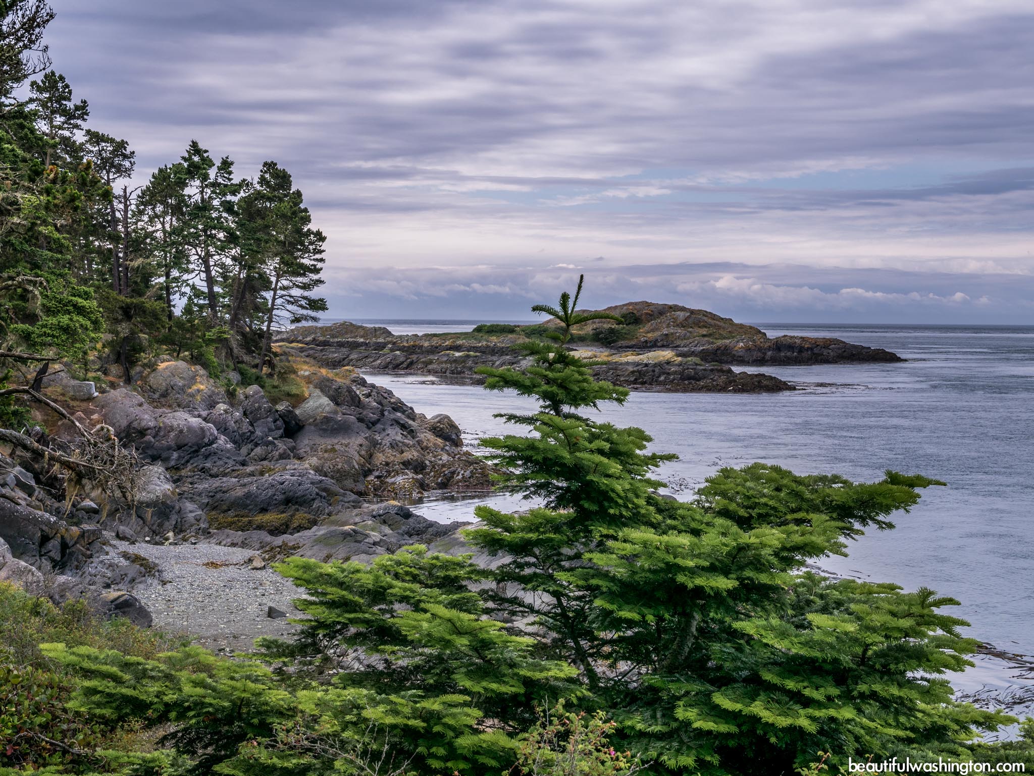
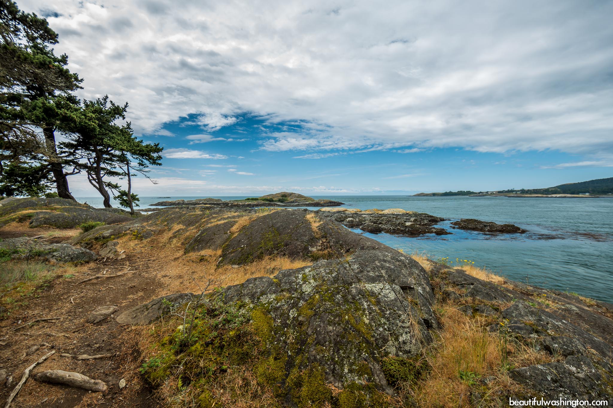
Shark Reef is located on the south west side of Lopez Island. This beautiful and easy hike takes its’ visitors through the peaceful forest to the rocky cliffs, opening stunning views of San Juan Channel.
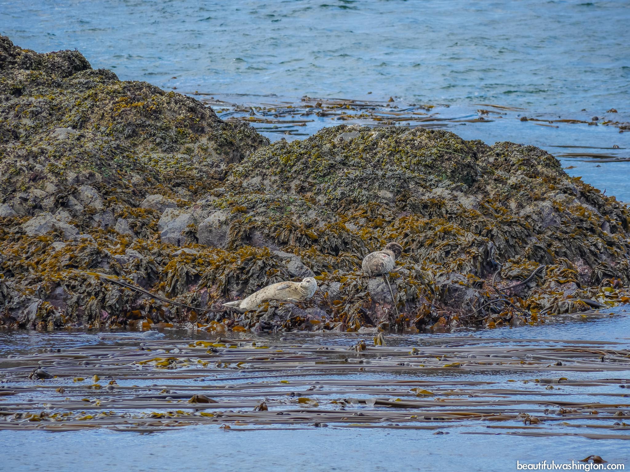
The park also offers the opportunity to explore both marine and bird life. Sometimes hikers may see Gray Whale and enjoy the seals.
It should be mentioned that Shark Reef Sanctuary was a military site, but it has been changed into the most spectacular hike.
The main goal for hikers is to find a sunny place and enjoy breathtaking and impressive views. Mount Finlayson is seen across the channel, as well as the highest mountain on the island – Dallas Mountain. If you look south, you will surely enjoy the snow-capped Olympics. Straight ahead you will see wonderful reefs and offshore rocks and Dead-man Island.
Shark Reef Sanctuary got its’ name thanks to a nearby reef. This place is one of the main attractions of the park not only because it is home for sea birds and seals, but also because it opens impressive views.
It should be said that the paths that run through the woods to the cliffs are relatively primitive. No camping, fires and bikes are allowed on the territory of Shark Reef Sanctuary. It will take you only fifteen minutes to get to the main attraction – the rocky cliffs that hang over the water.
Many hikers continue to go down to the water to explore rock formations, tide pools and kelp beds.
Directions:
From the Lopez ferry landing
Follow Ferry Road, turn right onto Fisherman Bay Road and drive for about 5 miles. Turn right onto Airport Road and turn left onto Shark Reef Road. Shark Reef Sanctuary will be in about 2 miles.
-
 Shark Reef Sanctuary 1
Shark Reef Sanctuary 1
Shark Reef Sanctuary 1
-
 Shark Reef Sanctuary 2
Shark Reef Sanctuary 2
Shark Reef Sanctuary 2
-
 Shark Reef Sanctuary 3
Shark Reef Sanctuary 3
Shark Reef Sanctuary 3
-
 Shark Reef Sanctuary 4
Shark Reef Sanctuary 4
Shark Reef Sanctuary 4
-
 Shark Reef Sanctuary 5
Shark Reef Sanctuary 5
Shark Reef Sanctuary 5
-
 Shark Reef Sanctuary 6
Shark Reef Sanctuary 6
Shark Reef Sanctuary 6
-
 Shark Reef Sanctuary 7
Shark Reef Sanctuary 7
Shark Reef Sanctuary 7
-
 Shark Reef Sanctuary 8
Shark Reef Sanctuary 8
Shark Reef Sanctuary 8
-
 Shark Reef Sanctuary 9
Shark Reef Sanctuary 9
Shark Reef Sanctuary 9
-
 Shark Reef Sanctuary 10
Shark Reef Sanctuary 10
Shark Reef Sanctuary 10
-
 Shark Reef Sanctuary 11
Shark Reef Sanctuary 11
Shark Reef Sanctuary 11
-
 Shark Reef Sanctuary 12
Shark Reef Sanctuary 12
Shark Reef Sanctuary 12
-
 Shark Reef Sanctuary 13
Shark Reef Sanctuary 13
Shark Reef Sanctuary 13
-
 Shark Reef Sanctuary 14
Shark Reef Sanctuary 14
Shark Reef Sanctuary 14
-
 Shark Reef Sanctuary 15
Shark Reef Sanctuary 15
Shark Reef Sanctuary 15
-
 Shark Reef Sanctuary 16
Shark Reef Sanctuary 16
Shark Reef Sanctuary 16
-
 Shark Reef Sanctuary 17
Shark Reef Sanctuary 17
Shark Reef Sanctuary 17
-
 Shark Reef Sanctuary 18
Shark Reef Sanctuary 18
Shark Reef Sanctuary 18
-
 Shark Reef Sanctuary 19
Shark Reef Sanctuary 19
Shark Reef Sanctuary 19
-
 Shark Reef Sanctuary 20
Shark Reef Sanctuary 20
Shark Reef Sanctuary 20
-
 Shark Reef Sanctuary 21
Shark Reef Sanctuary 21
Shark Reef Sanctuary 21
-
 Shark Reef Sanctuary 22
Shark Reef Sanctuary 22
Shark Reef Sanctuary 22
-
 Shark Reef Sanctuary 23
Shark Reef Sanctuary 23
Shark Reef Sanctuary 23
-
 Shark Reef Sanctuary 24
Shark Reef Sanctuary 24
Shark Reef Sanctuary 24
-
 Shark Reef Sanctuary 25
Shark Reef Sanctuary 25
Shark Reef Sanctuary 25
-
 Shark Reef Sanctuary 26
Shark Reef Sanctuary 26
Shark Reef Sanctuary 26
-
 Shark Reef Sanctuary 27
Shark Reef Sanctuary 27
Shark Reef Sanctuary 27
-
 Shark Reef Sanctuary 28
Shark Reef Sanctuary 28
Shark Reef Sanctuary 28
-
 Shark Reef Sanctuary 29
Shark Reef Sanctuary 29
Shark Reef Sanctuary 29
-
 Shark Reef Sanctuary 30
Shark Reef Sanctuary 30
Shark Reef Sanctuary 30
-
 Shark Reef Sanctuary 31
Shark Reef Sanctuary 31
Shark Reef Sanctuary 31
-
 Shark Reef Sanctuary 32
Shark Reef Sanctuary 32
Shark Reef Sanctuary 32
-
 Shark Reef Sanctuary 33
Shark Reef Sanctuary 33
Shark Reef Sanctuary 33
-
 Shark Reef Sanctuary 34
Shark Reef Sanctuary 34
Shark Reef Sanctuary 34
-
 Shark Reef Sanctuary 35
Shark Reef Sanctuary 35
Shark Reef Sanctuary 35
-
 Shark Reef Sanctuary 36
Shark Reef Sanctuary 36
Shark Reef Sanctuary 36
-
 Shark Reef Sanctuary 37
Shark Reef Sanctuary 37
Shark Reef Sanctuary 37
-
 Shark Reef Sanctuary 38
Shark Reef Sanctuary 38
Shark Reef Sanctuary 38
-
 Shark Reef Sanctuary 39
Shark Reef Sanctuary 39
Shark Reef Sanctuary 39
-
 Shark Reef Sanctuary 40
Shark Reef Sanctuary 40
Shark Reef Sanctuary 40
-
 Shark Reef Sanctuary 41
Shark Reef Sanctuary 41
Shark Reef Sanctuary 41
-
 Shark Reef Sanctuary 42
Shark Reef Sanctuary 42
Shark Reef Sanctuary 42
-
 Shark Reef Sanctuary 43
Shark Reef Sanctuary 43
Shark Reef Sanctuary 43
-
 Shark Reef Sanctuary 44
Shark Reef Sanctuary 44
Shark Reef Sanctuary 44
-
 Shark Reef Sanctuary 45
Shark Reef Sanctuary 45
Shark Reef Sanctuary 45
-
 Shark Reef Sanctuary 46
Shark Reef Sanctuary 46
Shark Reef Sanctuary 46
-
 Shark Reef Sanctuary 47
Shark Reef Sanctuary 47
Shark Reef Sanctuary 47
-
 Shark Reef Sanctuary 48
Shark Reef Sanctuary 48
Shark Reef Sanctuary 48
-
 Shark Reef Sanctuary 49
Shark Reef Sanctuary 49
Shark Reef Sanctuary 49
-
 Shark Reef Sanctuary 50
Shark Reef Sanctuary 50
Shark Reef Sanctuary 50
-
 Shark Reef Sanctuary 51
Shark Reef Sanctuary 51
Shark Reef Sanctuary 51
-
 Shark Reef Sanctuary 52
Shark Reef Sanctuary 52
Shark Reef Sanctuary 52
-
 Shark Reef Sanctuary 53
Shark Reef Sanctuary 53
Shark Reef Sanctuary 53
-
 Shark Reef Sanctuary 54
Shark Reef Sanctuary 54
Shark Reef Sanctuary 54
-
 Shark Reef Sanctuary 55
Shark Reef Sanctuary 55
Shark Reef Sanctuary 55
https://beautifulwashington.com/north-cascades/hiking/islands/lopez-island/222-shark-reef-sanctuary.html?tmpl=component&print=1&layout=default&page=#sigProId5e055dfaf5
These pictures were taken on June 13, 2014
In order to get the directions click on the link below:
Photo: Roman Khomlyak
Photo Editing: Pavlo Petryshyn
Information: Marina Petrova


