| Address: | 8608-8628 Lewis and Clark Highway, Lyle, WA 98635, USA |
| Roundtrip: | 1.0 mile |
| Elevation Gain: | 150 ft |
| Highest Point: | 500 ft |
| Features: | Wildflowers, rivers, lakes |
| Visitor’s Information: |
Discover Pass Required |
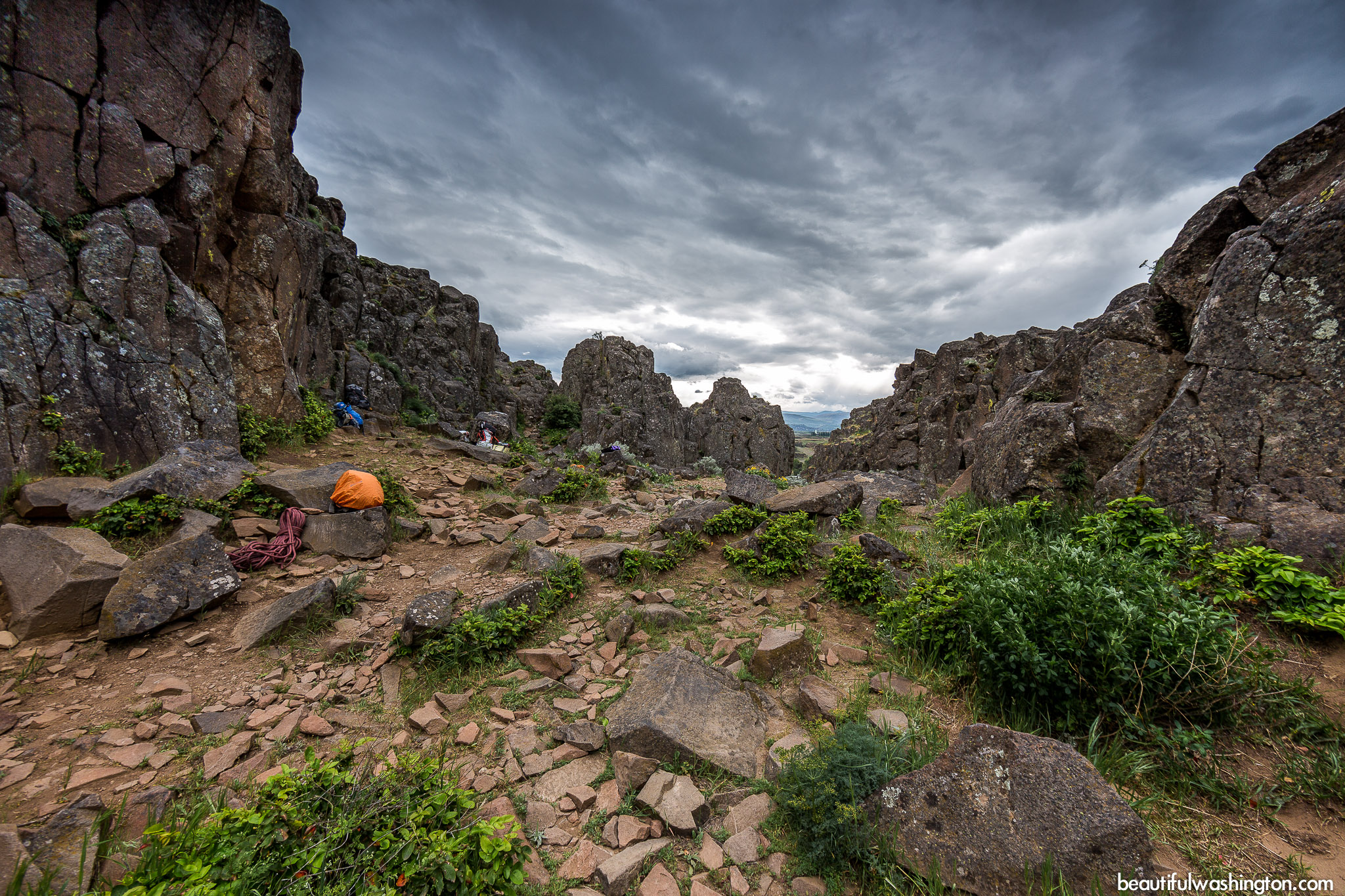
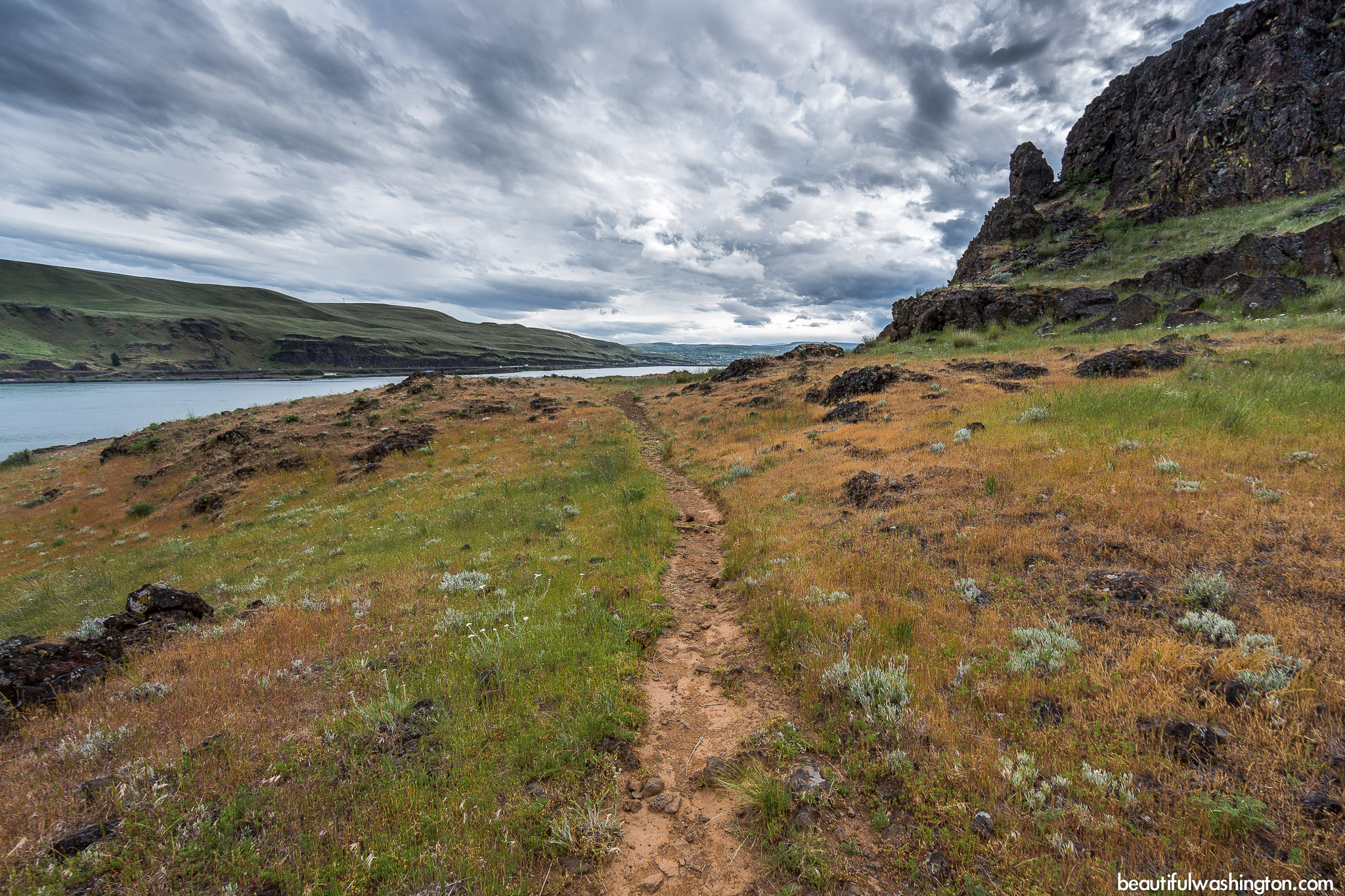
 Pictures below will take you on a virtual tour to the top of the Butte! The views from the top are breathtaking! Enjoy!
General Information:
The Horsethief Butte Trail can be found in Columbia Hills State Park, the South Cascades. The Butte is the jewel of this area; it is situated near a beautiful 90-acre lake. From the top of the horseshoe-shaped natural monument visitors enjoy breathtaking and spectacular views.
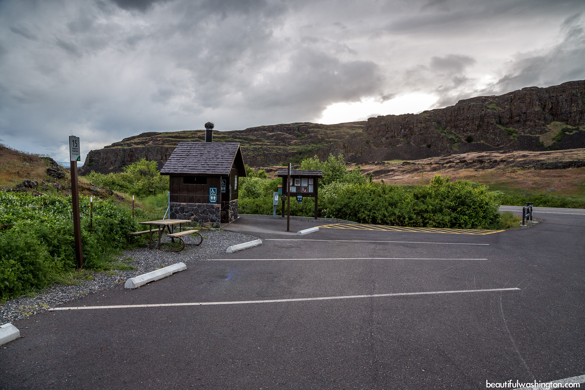
The trailhead is found at a new parking lot where a newly founded trailhead facility is located.
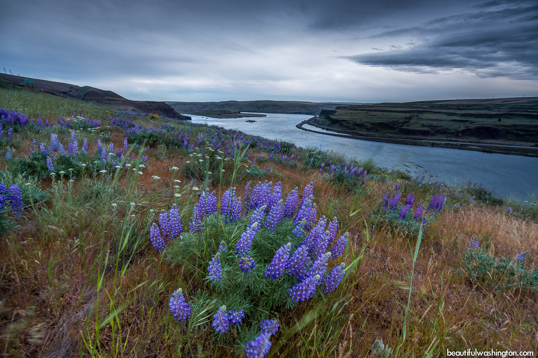
The best time to visit the Horsethief Butte is late spring when all the meadows are covered with colorful and beautiful wildflowers.
Lupine, balsamroot, white biscuit root, salt-and-pepper lomatium, yellow bells and many others flowers cover the ground.
On the top of the Butte enjoy the beauty and the might of the Columbia River that runs through the gorge. If you are lucky to hike here on a clear day, you will surely enjoy the views of snow-capped Mt. Hood and yellow farmlands of Oregon.
From the trailhead, the main path takes you to Horsethief Butte. If you decide to take the right path from the main one, it will take you around the natural monument to the cliffs above the Columbia River.
It should be said that the elevation of the Horsethief Butte is 500 feet, and it will take you about to hours to explore this trail with all the buffs and cliffs. If you are considering camping here, there is a small campground near Horsethief Lake, which is open seasonally. The largest camping site along the Columbia River is located in 18 miles in Maryhill State Park, this is the largest campground on this side of the gorge.
Horsethief Butte is also popular among rock climbers. They come here mostly in spring to enjoy the colors and good weather.
The Butte and the channel, where the Columbia River flows, were carved out of basalt rock by floods after the last ice age. The basalt rock were formed thanks to a series of lava flows which covered the entire Eastern Washington and Oregon region. Historians say that it happened long before the ice-age floods.
-
 Horsethief Butte Trail 1
Horsethief Butte Trail 1
Horsethief Butte Trail 1
-
 Horsethief Butte Trail 2
Horsethief Butte Trail 2
Horsethief Butte Trail 2
-
 Horsethief Butte Trail 3
Horsethief Butte Trail 3
Horsethief Butte Trail 3
-
 Horsethief Butte Trail 4
Horsethief Butte Trail 4
Horsethief Butte Trail 4
-
 Horsethief Butte Trail 5
Horsethief Butte Trail 5
Horsethief Butte Trail 5
-
 Horsethief Butte Trail 6
Horsethief Butte Trail 6
Horsethief Butte Trail 6
-
 Horsethief Butte Trail 7
Horsethief Butte Trail 7
Horsethief Butte Trail 7
-
 Horsethief Butte Trail 8
Horsethief Butte Trail 8
Horsethief Butte Trail 8
-
 Horsethief Butte Trail 9
Horsethief Butte Trail 9
Horsethief Butte Trail 9
-
 Horsethief Butte Trail 10
Horsethief Butte Trail 10
Horsethief Butte Trail 10
-
 Horsethief Butte Trail 11
Horsethief Butte Trail 11
Horsethief Butte Trail 11
-
 Horsethief Butte Trail 12
Horsethief Butte Trail 12
Horsethief Butte Trail 12
-
 Horsethief Butte Trail 13
Horsethief Butte Trail 13
Horsethief Butte Trail 13
-
 Horsethief Butte Trail 14
Horsethief Butte Trail 14
Horsethief Butte Trail 14
-
 Horsethief Butte Trail 15
Horsethief Butte Trail 15
Horsethief Butte Trail 15
-
 Horsethief Butte Trail 16
Horsethief Butte Trail 16
Horsethief Butte Trail 16
-
 Horsethief Butte Trail 17
Horsethief Butte Trail 17
Horsethief Butte Trail 17
-
 Horsethief Butte Trail 18
Horsethief Butte Trail 18
Horsethief Butte Trail 18
-
 Horsethief Butte Trail 19
Horsethief Butte Trail 19
Horsethief Butte Trail 19
-
 Horsethief Butte Trail 20
Horsethief Butte Trail 20
Horsethief Butte Trail 20
-
 Horsethief Butte Trail 21
Horsethief Butte Trail 21
Horsethief Butte Trail 21
-
 Horsethief Butte Trail 22
Horsethief Butte Trail 22
Horsethief Butte Trail 22
-
 Horsethief Butte Trail 23
Horsethief Butte Trail 23
Horsethief Butte Trail 23
-
 Horsethief Butte Trail 24
Horsethief Butte Trail 24
Horsethief Butte Trail 24
-
 Horsethief Butte Trail 25
Horsethief Butte Trail 25
Horsethief Butte Trail 25
-
 Horsethief Butte Trail 26
Horsethief Butte Trail 26
Horsethief Butte Trail 26
-
 Horsethief Butte Trail 27
Horsethief Butte Trail 27
Horsethief Butte Trail 27
-
 Horsethief Butte Trail 28
Horsethief Butte Trail 28
Horsethief Butte Trail 28
-
 Horsethief Butte Trail 29
Horsethief Butte Trail 29
Horsethief Butte Trail 29
-
 Horsethief Butte Trail 30
Horsethief Butte Trail 30
Horsethief Butte Trail 30
-
 Horsethief Butte Trail 31
Horsethief Butte Trail 31
Horsethief Butte Trail 31
-
 Horsethief Butte Trail 32
Horsethief Butte Trail 32
Horsethief Butte Trail 32
-
 Horsethief Butte Trail 33
Horsethief Butte Trail 33
Horsethief Butte Trail 33
-
 Horsethief Butte Trail 34
Horsethief Butte Trail 34
Horsethief Butte Trail 34
-
 Horsethief Butte Trail 35
Horsethief Butte Trail 35
Horsethief Butte Trail 35
-
 Horsethief Butte Trail 36
Horsethief Butte Trail 36
Horsethief Butte Trail 36
-
 Horsethief Butte Trail 37
Horsethief Butte Trail 37
Horsethief Butte Trail 37
-
 Horsethief Butte Trail 38
Horsethief Butte Trail 38
Horsethief Butte Trail 38
-
 Horsethief Butte Trail 39
Horsethief Butte Trail 39
Horsethief Butte Trail 39
-
 Horsethief Butte Trail 40
Horsethief Butte Trail 40
Horsethief Butte Trail 40
-
 Horsethief Butte Trail 41
Horsethief Butte Trail 41
Horsethief Butte Trail 41
-
 Horsethief Butte Trail 42
Horsethief Butte Trail 42
Horsethief Butte Trail 42
-
 Horsethief Butte Trail 43
Horsethief Butte Trail 43
Horsethief Butte Trail 43
-
 Horsethief Butte Trail 44
Horsethief Butte Trail 44
Horsethief Butte Trail 44
-
 Horsethief Butte Trail 45
Horsethief Butte Trail 45
Horsethief Butte Trail 45
-
 Horsethief Butte Trail 46
Horsethief Butte Trail 46
Horsethief Butte Trail 46
-
 Horsethief Butte Trail 47
Horsethief Butte Trail 47
Horsethief Butte Trail 47
-
 Horsethief Butte Trail 48
Horsethief Butte Trail 48
Horsethief Butte Trail 48
-
 Horsethief Butte Trail 49
Horsethief Butte Trail 49
Horsethief Butte Trail 49
-
 Horsethief Butte Trail 50
Horsethief Butte Trail 50
Horsethief Butte Trail 50
-
 Horsethief Butte Trail 51
Horsethief Butte Trail 51
Horsethief Butte Trail 51
-
 Horsethief Butte Trail 52
Horsethief Butte Trail 52
Horsethief Butte Trail 52
-
 Horsethief Butte Trail 53
Horsethief Butte Trail 53
Horsethief Butte Trail 53
-
 Horsethief Butte Trail 54
Horsethief Butte Trail 54
Horsethief Butte Trail 54
-
 Horsethief Butte Trail 55
Horsethief Butte Trail 55
Horsethief Butte Trail 55
-
 Horsethief Butte Trail 56
Horsethief Butte Trail 56
Horsethief Butte Trail 56
-
 Horsethief Butte Trail 57
Horsethief Butte Trail 57
Horsethief Butte Trail 57
-
 Horsethief Butte Trail 58
Horsethief Butte Trail 58
Horsethief Butte Trail 58
-
 Horsethief Butte Trail 59
Horsethief Butte Trail 59
Horsethief Butte Trail 59
-
 Horsethief Butte Trail 60
Horsethief Butte Trail 60
Horsethief Butte Trail 60
-
 Horsethief Butte Trail 61
Horsethief Butte Trail 61
Horsethief Butte Trail 61
-
 Horsethief Butte Trail 62
Horsethief Butte Trail 62
Horsethief Butte Trail 62
-
 Horsethief Butte Trail 63
Horsethief Butte Trail 63
Horsethief Butte Trail 63
-
 Horsethief Butte Trail 64
Horsethief Butte Trail 64
Horsethief Butte Trail 64
-
 Horsethief Butte Trail 65
Horsethief Butte Trail 65
Horsethief Butte Trail 65
-
 Horsethief Butte Trail 66
Horsethief Butte Trail 66
Horsethief Butte Trail 66
-
 Horsethief Butte Trail 67
Horsethief Butte Trail 67
Horsethief Butte Trail 67
-
 Horsethief Butte Trail 68
Horsethief Butte Trail 68
Horsethief Butte Trail 68
-
 Horsethief Butte Trail 69
Horsethief Butte Trail 69
Horsethief Butte Trail 69
https://beautifulwashington.com/eastern-washington/hiking/dallesport/columbia-hills-state-park/199-horsethief-butte-trail.html?tmpl=component&print=1&layout=default&page=#sigProId526ac4129b
These pictures were taken on May 3, 2014
Directions:
From Yakima
Drive east on Interstate 82 and take Exit 37 (US Highway 97/Goldendale). Drive till a signed right-turn only to US 97/Goldendale once you reach Toppenish. Drive south on US 97 through Goldendale till a junction with State Route 14. Drive west on SR 14 for 14.7 miles and find the Horsethief Butte trailhead on your left. If you come from the west, drive 1.2 miles past the entrance to Horsethief Lake State Park. Visitors can park along SR 14 on either side of the highway.
Click on the map below to get the directions to the park
Photo: Roman Khomlyak
Photo Editing: Pavlo Petryshyn
Information: Marina Petrova


