Quote of the Month:
“Nature gives to every time and season some beauties of its own." - Charles Dickens
“Nature gives to every time and season some beauties of its own." - Charles Dickens
| Location: | Eastern Washington |
| Roundtrip: | 4 miles |
| Elevation Gain: | 650 ft |
| Highest Point: | 2250 ft |
| GPS Coordinates: | N 47 51.837 W 119 07.305 |
| Visitor’s Information: |
Discover Pass Required |

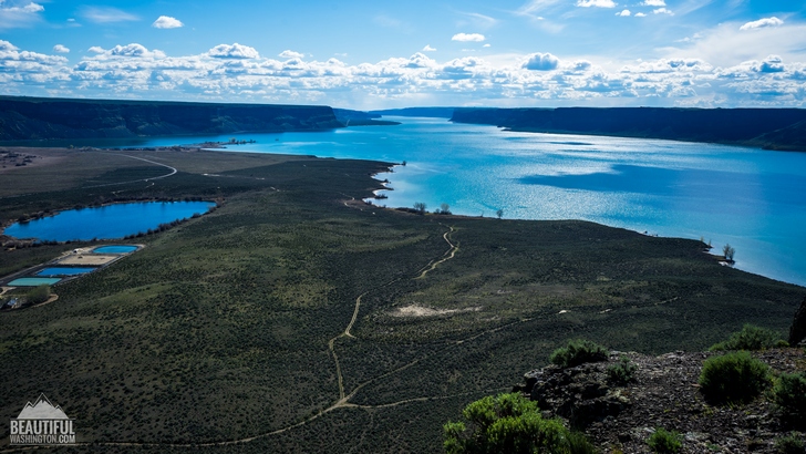
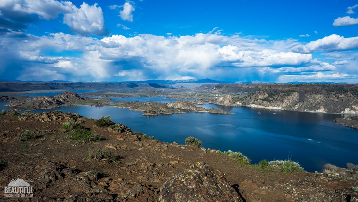
Steamboat Rock Trail is a perfect spring trail, it is only 2 miles long (one way), but the views that it offers are stunning.
Steamboat Rock is a massive basalt formation near Banks Lake that is located 700 feet above the waters of the lake. The flat top of the “basalt island” opens fabulous views of the lake and the surrounding of the Steamboat State Park.

Steamboat Rock has been used a landmark for many years. Indians, further traders and other expeditions travelled through this place. The rock was formed during the Great Missoula Floods and was surrounded by the waters from the Grand Coulee Dam.
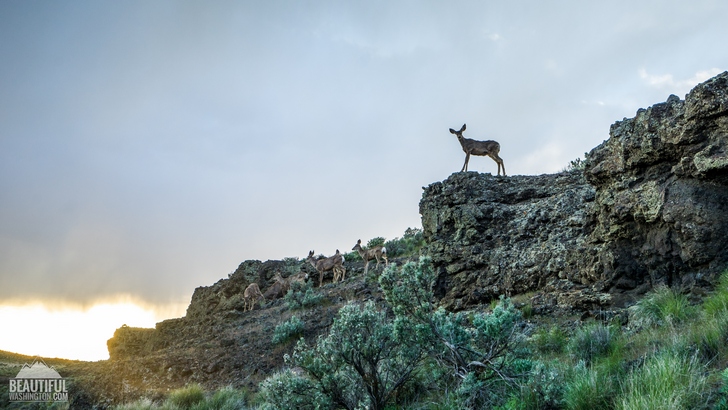
This is a very scenic hike that starts at the parking lot and takes you to the plateau on the top of the rock. Enjoy wildflowers along the trail before it gets steep. When the trail gets steep, be attentive and watch your steps. Though it will be difficult, especially if you are lucky to see gorgeous deer! Look at their perfect stature!

Well on the way to the top, enjoy the views and beautiful balsamroot and sagebrush. Here the trail splits, but both ways will bring you to the top.
The next section of the trail provides fabulous views if you look down, crystal waters of the lake and the prairie scenery around.
Enjoy your time on the top, have a sit and bask in the sunshine before you head back to your car.
 Steamboat Rock Trail 1
Steamboat Rock Trail 1
Steamboat Rock Trail 1
 Steamboat Rock Trail 2
Steamboat Rock Trail 2
Steamboat Rock Trail 2
 Steamboat Rock Trail 3
Steamboat Rock Trail 3
Steamboat Rock Trail 3
 Steamboat Rock Trail 4
Steamboat Rock Trail 4
Steamboat Rock Trail 4
 Steamboat Rock Trail 5
Steamboat Rock Trail 5
Steamboat Rock Trail 5
 Steamboat Rock Trail 6
Steamboat Rock Trail 6
Steamboat Rock Trail 6
 Steamboat Rock Trail 7
Steamboat Rock Trail 7
Steamboat Rock Trail 7
 Steamboat Rock Trail 8
Steamboat Rock Trail 8
Steamboat Rock Trail 8
 Steamboat Rock Trail 9
Steamboat Rock Trail 9
Steamboat Rock Trail 9
 Steamboat Rock Trail 10
Steamboat Rock Trail 10
Steamboat Rock Trail 10
 Steamboat Rock Trail 11
Steamboat Rock Trail 11
Steamboat Rock Trail 11
 Steamboat Rock Trail 12
Steamboat Rock Trail 12
Steamboat Rock Trail 12
 Steamboat Rock Trail 13
Steamboat Rock Trail 13
Steamboat Rock Trail 13
 Steamboat Rock Trail 14
Steamboat Rock Trail 14
Steamboat Rock Trail 14
 Steamboat Rock Trail 15
Steamboat Rock Trail 15
Steamboat Rock Trail 15
 Steamboat Rock Trail 16
Steamboat Rock Trail 16
Steamboat Rock Trail 16
 Steamboat Rock Trail 17
Steamboat Rock Trail 17
Steamboat Rock Trail 17
 Steamboat Rock Trail 18
Steamboat Rock Trail 18
Steamboat Rock Trail 18
 Steamboat Rock Trail 19
Steamboat Rock Trail 19
Steamboat Rock Trail 19
 Steamboat Rock Trail 20
Steamboat Rock Trail 20
Steamboat Rock Trail 20
 Steamboat Rock Trail 21
Steamboat Rock Trail 21
Steamboat Rock Trail 21
 Steamboat Rock Trail 22
Steamboat Rock Trail 22
Steamboat Rock Trail 22
 Steamboat Rock Trail 23
Steamboat Rock Trail 23
Steamboat Rock Trail 23
 Steamboat Rock Trail 24
Steamboat Rock Trail 24
Steamboat Rock Trail 24
 Steamboat Rock Trail 25
Steamboat Rock Trail 25
Steamboat Rock Trail 25
 Steamboat Rock Trail 26
Steamboat Rock Trail 26
Steamboat Rock Trail 26
 Steamboat Rock Trail 27
Steamboat Rock Trail 27
Steamboat Rock Trail 27
 Steamboat Rock Trail 28
Steamboat Rock Trail 28
Steamboat Rock Trail 28
 Steamboat Rock Trail 29
Steamboat Rock Trail 29
Steamboat Rock Trail 29
 Steamboat Rock Trail 30
Steamboat Rock Trail 30
Steamboat Rock Trail 30
 Steamboat Rock Trail 31
Steamboat Rock Trail 31
Steamboat Rock Trail 31
 Steamboat Rock Trail 32
Steamboat Rock Trail 32
Steamboat Rock Trail 32
 Steamboat Rock Trail 33
Steamboat Rock Trail 33
Steamboat Rock Trail 33
 Steamboat Rock Trail 34
Steamboat Rock Trail 34
Steamboat Rock Trail 34
 Steamboat Rock Trail 35
Steamboat Rock Trail 35
Steamboat Rock Trail 35
 Steamboat Rock Trail 36
Steamboat Rock Trail 36
Steamboat Rock Trail 36
 Steamboat Rock Trail 37
Steamboat Rock Trail 37
Steamboat Rock Trail 37
 Steamboat Rock Trail 38
Steamboat Rock Trail 38
Steamboat Rock Trail 38
 Steamboat Rock Trail 39
Steamboat Rock Trail 39
Steamboat Rock Trail 39
 Steamboat Rock Trail 40
Steamboat Rock Trail 40
Steamboat Rock Trail 40
 Steamboat Rock Trail 41
Steamboat Rock Trail 41
Steamboat Rock Trail 41
 Steamboat Rock Trail 42
Steamboat Rock Trail 42
Steamboat Rock Trail 42
 Steamboat Rock Trail 43
Steamboat Rock Trail 43
Steamboat Rock Trail 43
 Steamboat Rock Trail 44
Steamboat Rock Trail 44
Steamboat Rock Trail 44
 Steamboat Rock Trail 45
Steamboat Rock Trail 45
Steamboat Rock Trail 45
 Steamboat Rock Trail 46
Steamboat Rock Trail 46
Steamboat Rock Trail 46
 Steamboat Rock Trail 47
Steamboat Rock Trail 47
Steamboat Rock Trail 47
 Steamboat Rock Trail 48
Steamboat Rock Trail 48
Steamboat Rock Trail 48
 Steamboat Rock Trail 49
Steamboat Rock Trail 49
Steamboat Rock Trail 49
 Steamboat Rock Trail 50
Steamboat Rock Trail 50
Steamboat Rock Trail 50
 Steamboat Rock Trail 51
Steamboat Rock Trail 51
Steamboat Rock Trail 51
 Steamboat Rock Trail 52
Steamboat Rock Trail 52
Steamboat Rock Trail 52
 Steamboat Rock Trail 53
Steamboat Rock Trail 53
Steamboat Rock Trail 53
 Steamboat Rock Trail 54
Steamboat Rock Trail 54
Steamboat Rock Trail 54
 Steamboat Rock Trail 55
Steamboat Rock Trail 55
Steamboat Rock Trail 55
 Steamboat Rock Trail 56
Steamboat Rock Trail 56
Steamboat Rock Trail 56
 Steamboat Rock Trail 57
Steamboat Rock Trail 57
Steamboat Rock Trail 57
 Steamboat Rock Trail 58
Steamboat Rock Trail 58
Steamboat Rock Trail 58
 Steamboat Rock Trail 59
Steamboat Rock Trail 59
Steamboat Rock Trail 59
 Steamboat Rock Trail 60
Steamboat Rock Trail 60
Steamboat Rock Trail 60
 Steamboat Rock Trail 61
Steamboat Rock Trail 61
Steamboat Rock Trail 61
 Steamboat Rock Trail 62
Steamboat Rock Trail 62
Steamboat Rock Trail 62
 Steamboat Rock Trail 63
Steamboat Rock Trail 63
Steamboat Rock Trail 63
 Steamboat Rock Trail 64
Steamboat Rock Trail 64
Steamboat Rock Trail 64
 Steamboat Rock Trail 65
Steamboat Rock Trail 65
Steamboat Rock Trail 65
 Steamboat Rock Trail 66
Steamboat Rock Trail 66
Steamboat Rock Trail 66
 Steamboat Rock Trail 67
Steamboat Rock Trail 67
Steamboat Rock Trail 67
From Ellensburg
Drive east on Interstate 90, look for exit 151 (State Route 283), signed "Ephrata/Soap Lake." Drive through Ephrata. At Soap Lake, take a north turn on State Route 17. Drive through Soap Lake and keep driving to SR 2. Turn right onto SR 2. In 4.2 miles, merge onto SR 155. Turn left into Steamboat Rock State Park.
In order to get directions click on the map below:
Photo: Roman Khomlyak
Photo Editing: Alex Mandryko
Information: Marina Petrova
Leave your comment