| Location: | Eastern Washington Region, Whitman County |
| Roundtrip: | 3,5 miles |
| Difficulty: | Moderate |
| Elevation Gain: | 650 feet |
| Highest Point: | 3,641 feet |
| GPS Coordinates: | N 46 52.214 W 117 09.187 |
| Visitor’s Information: |
No Permit is needed for parking Dogs are allowed on a leash |
Pictures below will take you on a virtual tour along a beautiful Pine Ridge Trail. Enjoy the breathtaking scinery and amazing nature!

General Information:
One of the reasons of immense popularity of Kamiak Butte County Park is the Pine Ridge Trail, which meandering along the forested slopes of the butte gives the hikers a wonderful chance to enjoy in full the beauty of this County Park, as well as the uniqueness of the Palouse area, surrounding the butte.
This 3,5 miles loop-trail starts at the day-use area, and gives two options to the park visitors to explore it in a clockwise direction (which is the usual direction most of the hikers are doing) or in the counterclockwise direction (but in this case the ascend will be much steeper).

Before starting your hike, please do not forget that the restrooms and water are available only at the day-use area, that is why, especially for a hike on a hot summer day, we recommend taking enough water with you on the trail.
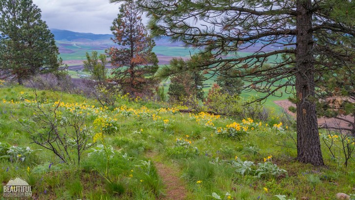
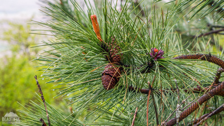
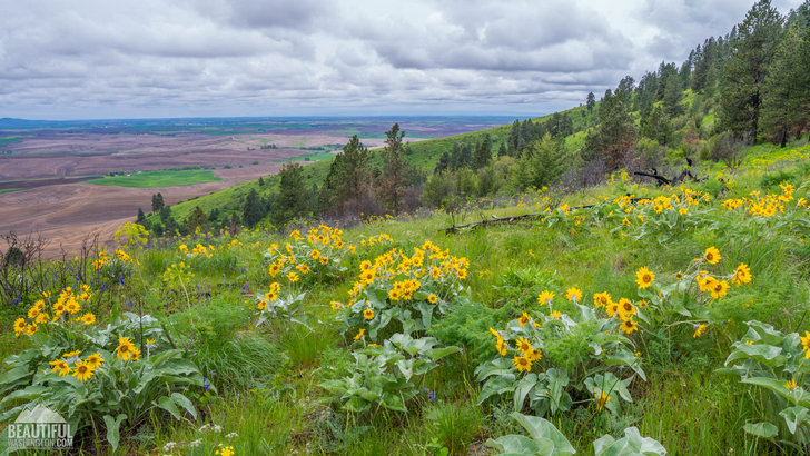
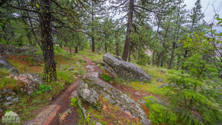
Several switchbacks will take you through the sparse forest of Western Larch, Douglas Fir and Ponderosa Pine to the top of the Kamiak Butte ridge. The singing birds will brighten your stroll with their merry warble. Enjoy the fascinating views of the surrounding farmlands and beautiful landscape of Palouse.

Reaching the top the trail continues following the ridgeline for some time, allowing you to admire the wild flowers which are especially plentiful during May and June. In approximately 0,5 mile you will notice a junction with a short spur trail, which can take you to the very top of the summit (the height of which is 3641 feet). Please mind, that it is located on a private land, that is why the park’s management requires to respect the property of the landlord.
Or you may just continue following the loop taking the right turn at the junction and starting to descend the butte northern hillside, which is densely forested and provides the heaven—sent coolness during the hot summer months.
In approximately one mile you will pass a “grassy trail”, which is actually used to be an old ski-run that failed after it was made because of the lack of snow at this hillside. If you continue following the main trail, you will soon meet another junction, turning right at which you will get to the second (upper) parking lot and Kamiak Butte County Park Campground. Following the left turn of the trail you will come back to your starting point.

During the hike remember, that the grassy lands of the butte can hide rattle snakes (which are not numerous there, but are still present), that is why it is recommended either to stay on the trail or to be extremely careful while walking on the grass-covered hills.
What is also important to remember is that the Kamiak Butte County Park is a gated park, and its gate is closed at dusk and is opened at 7am. You do not need any permit to park at the park’s parking lot. And the dogs are allowed in the park and on the trail on a leash.
-
 Pine Ridge Trail 1
Pine Ridge Trail 1
Pine Ridge Trail 1
-
 Pine Ridge Trail 2
Pine Ridge Trail 2
Pine Ridge Trail 2
-
 Pine Ridge Trail 3
Pine Ridge Trail 3
Pine Ridge Trail 3
-
 Pine Ridge Trail 4
Pine Ridge Trail 4
Pine Ridge Trail 4
-
 Pine Ridge Trail 5
Pine Ridge Trail 5
Pine Ridge Trail 5
-
 Pine Ridge Trail 6
Pine Ridge Trail 6
Pine Ridge Trail 6
-
 Pine Ridge Trail 7
Pine Ridge Trail 7
Pine Ridge Trail 7
-
 Pine Ridge Trail 8
Pine Ridge Trail 8
Pine Ridge Trail 8
-
 Pine Ridge Trail 9
Pine Ridge Trail 9
Pine Ridge Trail 9
-
 Pine Ridge Trail 10
Pine Ridge Trail 10
Pine Ridge Trail 10
-
 Pine Ridge Trail 11
Pine Ridge Trail 11
Pine Ridge Trail 11
-
 Pine Ridge Trail 12
Pine Ridge Trail 12
Pine Ridge Trail 12
-
 Pine Ridge Trail 13
Pine Ridge Trail 13
Pine Ridge Trail 13
-
 Pine Ridge Trail 14
Pine Ridge Trail 14
Pine Ridge Trail 14
-
 Pine Ridge Trail 15
Pine Ridge Trail 15
Pine Ridge Trail 15
-
 Pine Ridge Trail 16
Pine Ridge Trail 16
Pine Ridge Trail 16
-
 Pine Ridge Trail 17
Pine Ridge Trail 17
Pine Ridge Trail 17
-
 Pine Ridge Trail 18
Pine Ridge Trail 18
Pine Ridge Trail 18
-
 Pine Ridge Trail 19
Pine Ridge Trail 19
Pine Ridge Trail 19
-
 Pine Ridge Trail 20
Pine Ridge Trail 20
Pine Ridge Trail 20
-
 Pine Ridge Trail 21
Pine Ridge Trail 21
Pine Ridge Trail 21
-
 Pine Ridge Trail 22
Pine Ridge Trail 22
Pine Ridge Trail 22
-
 Pine Ridge Trail 23
Pine Ridge Trail 23
Pine Ridge Trail 23
-
 Pine Ridge Trail 24
Pine Ridge Trail 24
Pine Ridge Trail 24
-
 Pine Ridge Trail 25
Pine Ridge Trail 25
Pine Ridge Trail 25
-
 Pine Ridge Trail 26
Pine Ridge Trail 26
Pine Ridge Trail 26
-
 Pine Ridge Trail 27
Pine Ridge Trail 27
Pine Ridge Trail 27
-
 Pine Ridge Trail 28
Pine Ridge Trail 28
Pine Ridge Trail 28
-
 Pine Ridge Trail 29
Pine Ridge Trail 29
Pine Ridge Trail 29
-
 Pine Ridge Trail 30
Pine Ridge Trail 30
Pine Ridge Trail 30
-
 Pine Ridge Trail 31
Pine Ridge Trail 31
Pine Ridge Trail 31
-
 Pine Ridge Trail 32
Pine Ridge Trail 32
Pine Ridge Trail 32
-
 Pine Ridge Trail 33
Pine Ridge Trail 33
Pine Ridge Trail 33
-
 Pine Ridge Trail 34
Pine Ridge Trail 34
Pine Ridge Trail 34
-
 Pine Ridge Trail 35
Pine Ridge Trail 35
Pine Ridge Trail 35
-
 Pine Ridge Trail 36
Pine Ridge Trail 36
Pine Ridge Trail 36
https://beautifulwashington.com/eastern-washington/hiking/537-pine-ridge-trail.html?tmpl=component&print=1&layout=default&page=#sigProId7dd72b4950
These pictures were taken on May 12, 2017
Driving Directions:
Coming from Pullman: you should take State Highway 27 North and drive for about 11 miles. Then turn left on Clear Creek Road and drive for 0.5 mile. Another left turn will take you to Fugate Road (Road No. 5100). Drive 0.5 mile to Kamiak Butte County Park Road (Rd. No. 6710) and continue till you reach the park entrance (on the left).
Coming from Colfax: you should take State Highway 272 (Palouse Highway) East and drive for 5 miles. Then turn right to Clear Creak Road and drive for 7 more miles. Then take a sharp right turn to Fugate Road (Road No. 5100) and drive 0.5 mile to Kamiak Butte County Park Road (Road No. 6710) and continue till you reach the park entrance (on the left).
GPS Coordinates: N 46 52.214 W 117 09.187
In order to get directions click on the map below:
Photo: Roman Khomlyak
Photo Editing: Juliana Voitsikhovska
Information: Svetlana Baranova