Quote of the Month:
“Nature gives to every time and season some beauties of its own." - Charles Dickens
“Nature gives to every time and season some beauties of its own." - Charles Dickens
| Location: | Central Cascades Region, Leavenworth Area |
| Roundtrip: | 8 miles |
| Difficulty: | Difficult |
| Elevation Gain: | 3380 feet |
| Highest Point: | 5580 feet |
| GPS Coordinates: | N 47 31.668 W -121 10.739 |
| Visitor’s Information: |
Northwest Forest Pass Required |

Central Cascades can be explored by numerous trails meandering through majestic mountains and lovely valleys, opening the unbelievable beauty of the region for the hikers. But the most gorgeous and breathtaking view you will find at the elevation of 5500 feet. And this is the view of Colchuck Lake – a fascinating alpine lake with Dragontail and Colchuck Peaks rising above it like fairy-tale giant twins, guarding their precious jewel. If you saw this enchanting sight at least once, you will never forget it, and will constantly fight the desire to come again and again back here.
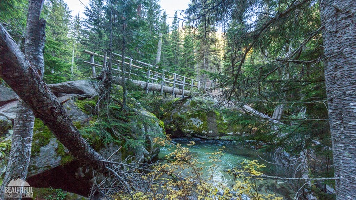
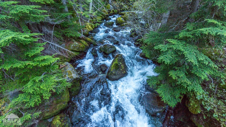
The route to Colchuck Lake starts as an easy amble at the Stuart Lake Trailhead, and first 2,5 miles (until the junction with the Colchuck Lake Trail) it follows the Stuart Lake Trail #1599. The first part of the trail (about 1,5 miles) runs through the forest, ascending quite gradually while following Mountaineer Creek, the sound of which you may hear from time to time. In approximately one and a half miles you will reach a log footbridge across the creek.

After crossing the bridge you will notice that the ascending grade became a little bit steeper. Be careful while walking along this part of the trail as there are quite many rocks and exposed tree roots on the path.
It will take you a little less than a mile to get to the trail junction where you should turn left to follow the Colchuck Lake Trail #1599.1. If you continue following the trail going straight forward you will reach Lake Stuart, another admirable destination of the area.
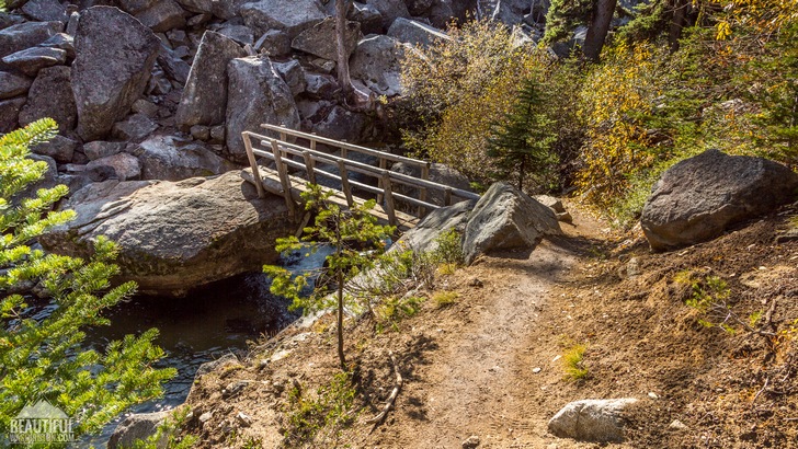
Very soon after passing the trail junction you will see another log footbridge across the creek, which you will need to cross one more time. Be careful making your way through the huge boulders on the other side of the creek.

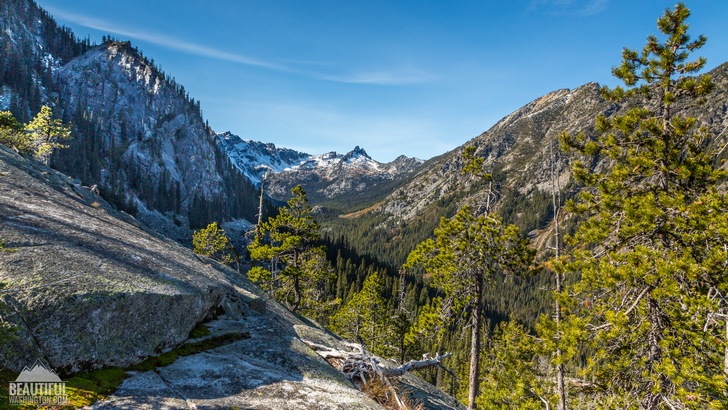
From this part of the trail the easy amble is finished and the real hike starts as the steep ascent of the trail with the rocks scattered along it will be quite a challenge demanding some good efforts. But the payoff at the end will be really priceless! During your final climb do not forget to enjoy the sweeping views of glorious Mount Stuart.

In approximately 1,5 miles you will finally see the enchanting turquoise waters of Colchuck Lake as you reach the north shore of this exquisite alpine lake. If you look south you will be able to admire the breathtaking views of Dragontail Peak (which is the left one) and Colchuck Peak (the right one). On the left side of Dragontail Peak the Aasgard Pass is located, leading to the extremely popular Enchantments.
The Colchuck Lake Trail runs along the western lakeshore leading the hikers to Aasgarв Pass.
There are quite many campsites around the lake, but you need to remember that for camping here you will need an overnight permit from June, 15th to October, 15th.
The dogs are not allowed on the trail and near the lake.
 Colchuck Lake Trail 1
Colchuck Lake Trail 1
Colchuck Lake Trail 1
 Colchuck Lake Trail 2
Colchuck Lake Trail 2
Colchuck Lake Trail 2
 Colchuck Lake Trail 3
Colchuck Lake Trail 3
Colchuck Lake Trail 3
 Colchuck Lake Trail 4
Colchuck Lake Trail 4
Colchuck Lake Trail 4
 Colchuck Lake Trail 5
Colchuck Lake Trail 5
Colchuck Lake Trail 5
 Colchuck Lake Trail 6
Colchuck Lake Trail 6
Colchuck Lake Trail 6
 Colchuck Lake Trail 7
Colchuck Lake Trail 7
Colchuck Lake Trail 7
 Colchuck Lake Trail 8
Colchuck Lake Trail 8
Colchuck Lake Trail 8
 Colchuck Lake Trail 9
Colchuck Lake Trail 9
Colchuck Lake Trail 9
 Colchuck Lake Trail 10
Colchuck Lake Trail 10
Colchuck Lake Trail 10
 Colchuck Lake Trail 11
Colchuck Lake Trail 11
Colchuck Lake Trail 11
 Colchuck Lake Trail 12
Colchuck Lake Trail 12
Colchuck Lake Trail 12
 Colchuck Lake Trail 13
Colchuck Lake Trail 13
Colchuck Lake Trail 13
 Colchuck Lake Trail 14
Colchuck Lake Trail 14
Colchuck Lake Trail 14
 Colchuck Lake Trail 15
Colchuck Lake Trail 15
Colchuck Lake Trail 15
 Colchuck Lake Trail 16
Colchuck Lake Trail 16
Colchuck Lake Trail 16
 Colchuck Lake Trail 17
Colchuck Lake Trail 17
Colchuck Lake Trail 17
 Colchuck Lake Trail 18
Colchuck Lake Trail 18
Colchuck Lake Trail 18
 Colchuck Lake Trail 19
Colchuck Lake Trail 19
Colchuck Lake Trail 19
 Colchuck Lake Trail 20
Colchuck Lake Trail 20
Colchuck Lake Trail 20
 Colchuck Lake Trail 21
Colchuck Lake Trail 21
Colchuck Lake Trail 21
 Colchuck Lake Trail 22
Colchuck Lake Trail 22
Colchuck Lake Trail 22
 Colchuck Lake Trail 23
Colchuck Lake Trail 23
Colchuck Lake Trail 23
 Colchuck Lake Trail 24
Colchuck Lake Trail 24
Colchuck Lake Trail 24
 Colchuck Lake Trail 25
Colchuck Lake Trail 25
Colchuck Lake Trail 25
 Colchuck Lake Trail 26
Colchuck Lake Trail 26
Colchuck Lake Trail 26
 Colchuck Lake Trail 27
Colchuck Lake Trail 27
Colchuck Lake Trail 27
 Colchuck Lake Trail 28
Colchuck Lake Trail 28
Colchuck Lake Trail 28
 Colchuck Lake Trail 29
Colchuck Lake Trail 29
Colchuck Lake Trail 29
 Colchuck Lake Trail 30
Colchuck Lake Trail 30
Colchuck Lake Trail 30
 Colchuck Lake Trail 31
Colchuck Lake Trail 31
Colchuck Lake Trail 31
 Colchuck Lake Trail 32
Colchuck Lake Trail 32
Colchuck Lake Trail 32
 Colchuck Lake Trail 33
Colchuck Lake Trail 33
Colchuck Lake Trail 33
 Colchuck Lake Trail 34
Colchuck Lake Trail 34
Colchuck Lake Trail 34
 Colchuck Lake Trail 35
Colchuck Lake Trail 35
Colchuck Lake Trail 35
 Colchuck Lake Trail 36
Colchuck Lake Trail 36
Colchuck Lake Trail 36
 Colchuck Lake Trail 37
Colchuck Lake Trail 37
Colchuck Lake Trail 37
 Colchuck Lake Trail 38
Colchuck Lake Trail 38
Colchuck Lake Trail 38
 Colchuck Lake Trail 39
Colchuck Lake Trail 39
Colchuck Lake Trail 39
 Colchuck Lake Trail 40
Colchuck Lake Trail 40
Colchuck Lake Trail 40
 Colchuck Lake Trail 41
Colchuck Lake Trail 41
Colchuck Lake Trail 41
 Colchuck Lake Trail 42
Colchuck Lake Trail 42
Colchuck Lake Trail 42
 Colchuck Lake Trail 43
Colchuck Lake Trail 43
Colchuck Lake Trail 43
 Colchuck Lake Trail 44
Colchuck Lake Trail 44
Colchuck Lake Trail 44
 Colchuck Lake Trail 45
Colchuck Lake Trail 45
Colchuck Lake Trail 45
 Colchuck Lake Trail 46
Colchuck Lake Trail 46
Colchuck Lake Trail 46
 Colchuck Lake Trail 47
Colchuck Lake Trail 47
Colchuck Lake Trail 47
 Colchuck Lake Trail 48
Colchuck Lake Trail 48
Colchuck Lake Trail 48
 Colchuck Lake Trail 49
Colchuck Lake Trail 49
Colchuck Lake Trail 49
 Colchuck Lake Trail 50
Colchuck Lake Trail 50
Colchuck Lake Trail 50
 Colchuck Lake Trail 51
Colchuck Lake Trail 51
Colchuck Lake Trail 51
 Colchuck Lake Trail 52
Colchuck Lake Trail 52
Colchuck Lake Trail 52
 Colchuck Lake Trail 53
Colchuck Lake Trail 53
Colchuck Lake Trail 53
 Colchuck Lake Trail 54
Colchuck Lake Trail 54
Colchuck Lake Trail 54
 Colchuck Lake Trail 55
Colchuck Lake Trail 55
Colchuck Lake Trail 55
 Colchuck Lake Trail 56
Colchuck Lake Trail 56
Colchuck Lake Trail 56
 Colchuck Lake Trail 57
Colchuck Lake Trail 57
Colchuck Lake Trail 57
 Colchuck Lake Trail 58
Colchuck Lake Trail 58
Colchuck Lake Trail 58
 Colchuck Lake Trail 59
Colchuck Lake Trail 59
Colchuck Lake Trail 59
 Colchuck Lake Trail 60
Colchuck Lake Trail 60
Colchuck Lake Trail 60
Drive on US2 going west through the city of Leavenworth till the end of the city, where you need to turn left to Icicle Road. After approximately 8,4 miles of following the Icicle Road take the left turn on Forest Service Road 7601. Drive 3,7 miles along this dirt road and you will reach the Stuart Lake trailhead. There is a parking lot for 30-40 cars at the trailhead, as well as a toilet. But there is no water sources there.
In order to get directions click on the map below:
Photo: Roman Khomlyak
Photo Editing: Juliana Voitsikhovska
Information: Svetlana Baranova
Leave your comment